
 Asset Publisher
LOCATION
 Mapa RDLP i lokalizacja N-ctwa (Autor K.Polus)
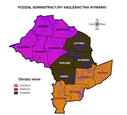 Podział administracyjny N-ctwa (Autor K.Polus)
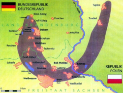 Największa na Ziemi morena czołowa. Źródło: Informator Regionalnej Dyrekcji LP w Ziel. Górze
 Żródło:www.borydolnoslaskie.org/
 fot. Mariusz Grondys
 fot. Mariusz Grondys
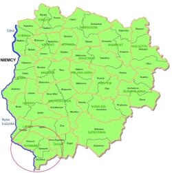
The Wymiarki Forest District is one of the twenty forest districts of the Regional Directorate of State Forests in Zielona Góra It is located in the South-West part of Lubuskie Province.
The western border of the Forest District is situated along the Polish border in line with the twenty-eight-kilometre-long stretch of the Lusatian Neisse River (Nysa Łużycka). The lands of the Forest District are located between 14º47'03" and 15º11'12" East longitude, and between 51º21'47" and 51º35'50" North latitude.
The territorial scope of the Wymiarki Forest District activity is 33187 ha. The Forest District manages lands located in two districts and seven communes.
Żary District, with the area of 22,836 ha (in communes such as: Trzebiel 2,210 ha, Lipinki Łużyckie 1,031 ha, Przewóz 17,832 ha, Żary 1,763 ha).
Żagań District, with the area of 10,351 ha (in communes such as: Iłowa 3,295 ha, Wymiarki 4,659 ha and the townof Gozdnica2,397 ha).
Asset Publisher


Asset Publisher
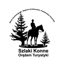
Horse paths
Horse paths
 Symbol projektu (Źródło: Stowarzyszenie LGD Bory Dolnośląskie)
 Przykład oznakowania szlaku konnego (Źródło: Stowarzyszenie LGD Bory Dolnośląskie)
 Konno przez bród (Źródło: Stowarzyszenie LGD Bory Dolnośląskie)
 pic00012.jpg

Horseback tourism comes back to life for a dozen or so years and it becomes not only the way of active rest. It appears that horse riding is an activity which is crucial in any travel offer prepared to fulfill contemporary tourist demands.
Under the http://www.disena.pl/bd/ link you will find routes of the Wymiarki Forest District horse paths.
Click the map below to download its large format
(Source: Local Action Group Lower Silesia Forests)